The Importance of Urban Flood Studies
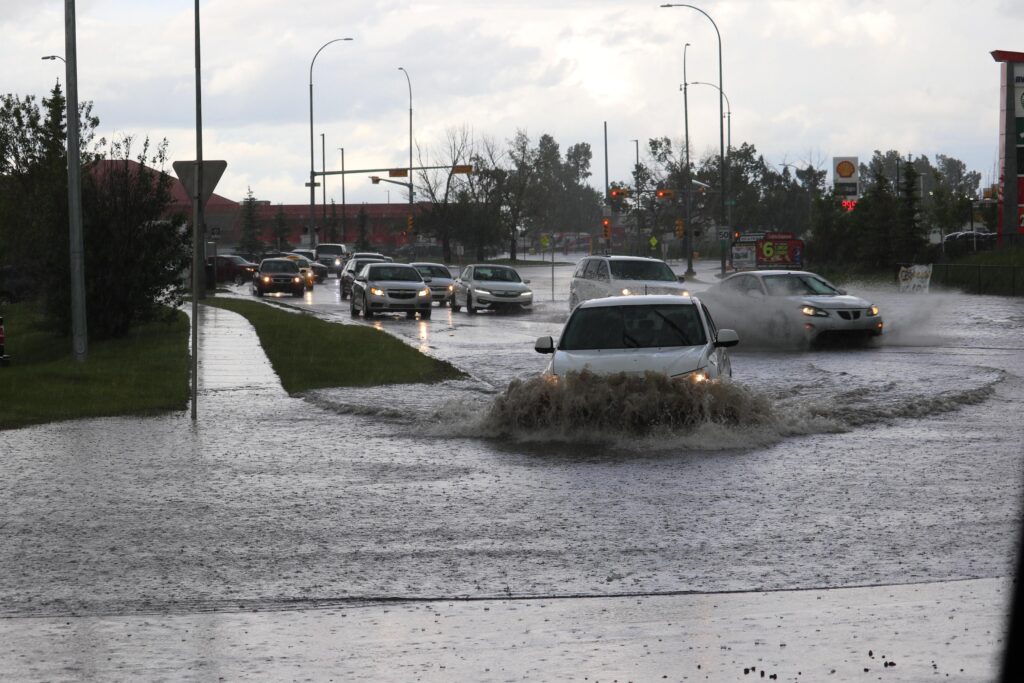
Flooding is a growing concern in urban areas worldwide, particularly in cities like Sydney,
where rapid development, changing weather patterns, and increasing impervious surfaces
(like roads and buildings) contribute to more frequent and severe flood events. To address
this issue, urban flood studies have become a critical tool for urban planners, developers,
engineers, and local authorities in managing and mitigating flood risk.
What is an Urban Flood Study?
An urban flood study is a comprehensive analysis that assesses the potential for flooding
within an urban environment. The study typically involves collecting data on local rainfall
patterns, topography, drainage systems, land use, and other factors that contribute to flood
risk. The goal is to understand how water behaves during storms or heavy rainfall, predict
where flooding is most likely to occur, and identify the impacts on both the built environment
and the natural ecosystem.
These studies employ a combination of historical data, hydrological models, and hydraulic
simulations to create a detailed picture of flood behaviour under various conditions. This
information helps city planners make better decisions about land use, infrastructure
development, and flood mitigation strategies.
Why Do We Conduct Urban Flood Studies?
1. Assessing Flood Risk and Vulnerability
One of the primary reasons for conducting an urban flood study is to identify flood-prone
areas within a city. Urban areas, with their dense development, limited green spaces, and
overburdened stormwater systems, are particularly susceptible to flooding. Urban flood
studies provide valuable insights into which areas are most vulnerable to both pluvial
flooding (from heavy rainfall) and fluvial flooding (from overflowing rivers or streams). This
helps decision-makers understand the scope of the problem and prioritize interventions.
2. Supporting Sustainable Urban Planning
As cities grow, it’s crucial to plan for the long-term resilience of urban infrastructure. By
integrating flood risk data into urban planning, local authorities can ensure that future
developments are designed with flood mitigation in mind. Urban flood studies help planners
make informed decisions about zoning regulations, building codes, and land use by
highlighting areas that are unsuitable for development due to flood risk. For example, flood
studies can identify areas where development should be restricted or where flood-resistant
construction techniques should be mandated.
3. Improving Stormwater Management
Urban flood studies help cities better understand the behaviour of stormwater. In urban
environments, impervious surfaces such as roads, rooftops, and parking lots prevent water
from naturally infiltrating into the ground, leading to increased runoff. This can overwhelm
stormwater drainage systems, resulting in localized flooding. Through hydrological
modelling, urban flood studies assess the capacity of existing drainage infrastructure and
suggest upgrades or alternatives, such as stormwater detention ponds, green infrastructure,
or permeable pavements, to better manage runoff and reduce flooding.
4. Designing Effective Flood Mitigation Measures
Understanding how and where floods are likely to occur allows engineers to design tailored
flood mitigation measures. These can include solutions like levees, flood barriers, raised
buildings, or flood-resistant infrastructure. An urban flood study can help optimize these
measures by providing accurate predictions of flood levels and flow patterns. For example,
an in-depth analysis can determine the best location for a flood levee to protect critical
infrastructure or identify areas where flood diversion channels could reduce the impact of
flooding.
5. Enhancing Emergency Preparedness and Response
Flood studies are crucial for developing effective emergency management plans. By
knowing which areas are most at risk during severe weather events, local authorities can
prepare evacuation routes, flood warning systems, and temporary shelters for affected
residents. Urban flood studies also allow authorities to plan for post-flood recovery, ensuring
that resources and services are available to help communities quickly bounce back from
flood damage.
6. Climate Change Adaptation
Climate change is contributing to more frequent and intense rainfall events, making it even
more important to understand how urban areas will respond to future flood risks. Urban flood
studies can incorporate climate projections to assess how flood risk may change under
different climate scenarios. This allows cities to adapt their infrastructure and flood
management strategies to meet the challenges posed by a changing climate, ensuring long-
term resilience.
7. Protecting Public Safety and Property
Ultimately, the goal of an urban flood study is to protect both public safety and property. By
providing detailed flood risk assessments, these studies help prevent loss of life, reduce
property damage, and minimize the economic impact of flooding. In flood-prone areas,
where evacuation and emergency response times are critical, accurate flood predictions can
save lives by allowing for timely warnings and preparedness.
How Do Urban Flood Studies Help Developers and Planners?
For developers, conducting an urban flood study is essential for securing planning
approvals. In flood-prone areas, councils often require flood studies to be submitted as part
of the development application process. These studies provide reassurance that the
proposed development will not exacerbate flooding issues and that necessary flood
mitigation measures are in place.
Urban flood studies also help developers design flood-resilient buildings, ensuring that new
structures meet safety standards and are protected against flood damage. This is particularly
important as more cities embrace sustainable development practices and seek to meet
resilience goals as part of their overall urban planning strategies.